UK Map App

Version 1.0 of UK Map was released on 13th April 2010 - ten years ago!
I'm taking this opportunity look back over the last decade, with this timeline of the app's history over its four major versions.
The Ordnance Survey "Open Data" programme was announced on 1st April 2010 and I started developing the app on the same day. This was good timing for me; I didn't have other work commitments, and I had some existing code that could be re-purposed for the new app. I felt sure that producing something quickly was the most important thing. Version 1.0 was submitted to Apple for review on 11th April and approved by them on the 13th.
Version 1.0 had a limited but useful set of features: as now, the 1:1,000,000 and 1:250,000 maps were built in and the detailed maps were downloaded in 5km squares. At that time there was only one choice of detailed maps, 1:10,000 "Ordnance Survey Street View".
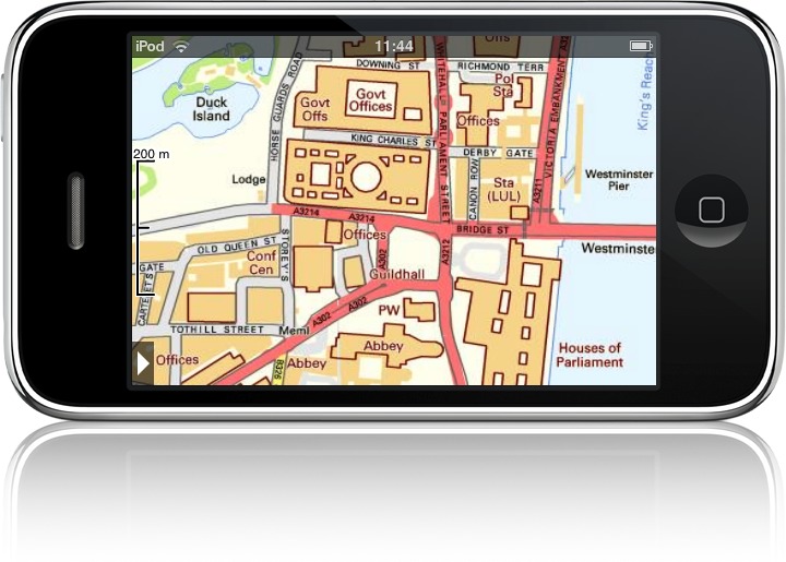
Screenshot of UK Map version 1.0, pasted onto an iPhone 3GS, as used on the original UK Map web site.
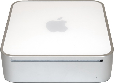
I developed this version using a Mac mini (£399) and the original iPod touch (£169). I still have these and I power on the iPod occasionally to remind myself how much things have moved on. (Today the cheapest Mac costs at least £799.)
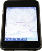
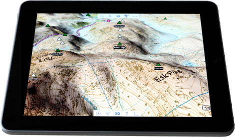
The small, low-resolution screen of those early iPods and iPhones was not ideal for maps, but there was a new product on the way that I believed would make a much better map viewer - the iPad! This had been announced in January, and I had one of the first ones in the UK, shipped from Texas (£369, plus £246 shipping and customs charges), and version 1.0 of UK Map worked on it.
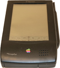
My original iPad also still works. It feels incredibly chunky compared to the more modern models. But this wasn't the first Apple tablet that I owned; I had worked for ARM in the early 1990s when they were developing the processor for the Apple Newton. The iPad was a huge improvement on that, in many ways. Sadly my Newton no longer powers on.
I spent the next month adding more features. Ordnance Survey had included contour line data with the first Open Data release, and I superimposed this onto the Street View base maps. I also added the hill shading effect, co-ordinate display, road name and postcode search, and compass.
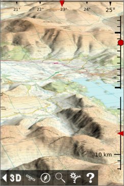
By July Ordnance Survey had released their Open Data 1:25,000 product, "Vector Map District". I added this to the app, and also added footpaths using data from OpenStreetMap; the resulting maps were now much more suitable for countryside use. These maps, combining Vector Map District with contour lines and OSM footpaths, remain the cornerstone of what UK Map offers ten years later.
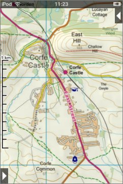
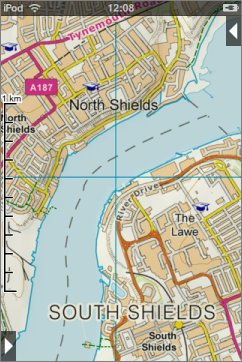
1:25,000 maps, with contour lines and footpaths, from version 1.2
I spent the next few months completely replacing much of the app's core to implement the 3D mode. I was pretty pleased with the result.
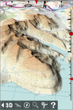
3D maps from version 2.0
For the next few years, although releases were limited to occasional bug fixes and updates for compatibility with new devices, I was still working on the app, getting it ready for another major update.
It is sometimes said that the last 10% of the functionality of a product takes 90% of the time, and developing version 3 of UK Map was a good example of that. Users had just a few small requests - they wanted to record and view their tracks, and import and export GPX files. This was a lot of work, the main challenges being creating a good user interface and smoothly updating the display on older devices when there were waypoints and tracks to show. But it was eventually finished.
Screenshot of UK Map version 3.0 showing GPX tracks and waypoints, pasted onto an iPhone 6, as used on the UK Map web site in 2017.
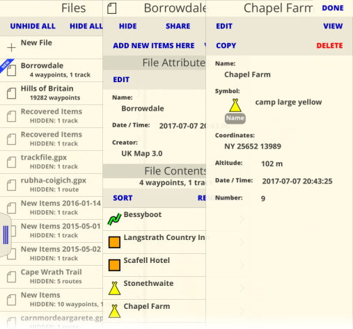
Part of the new user interface for GPX files in version 3.0.
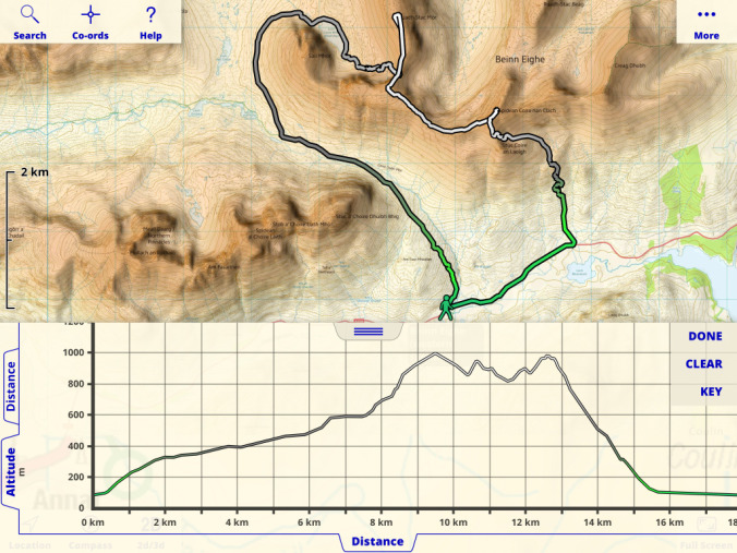
Altitude profile for a walk on Beinn Eighe, in version 3.0.
There were just a few remaining missing features, which were added in the next updates. A few people had asked for the ability to annotate the map with photos, and I made it possible to show photos from your iOS photo albums on the map. Finally I added the ability to draw routes on the map.
My intention had always been to use the Open Data maps to offer something different from other apps - not quite as good as the paper OS maps, but considerably cheaper. But users had often suggested that I should also offer paid OS maps; they complained that they preferred my app but had to swap to another one when they wanted to view a "proper" map.
Much of the work involved deciding how to divide up the country for the in-app purchases, and giving those regions names. Then, once again, the user new interface for the map store took a lot of time.
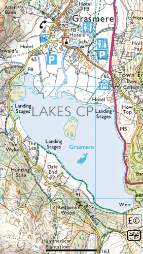
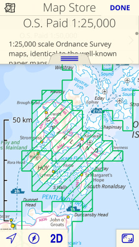
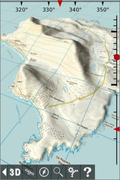
1:25,000 Paid map of Grasmere, and part of the new Map Store user interface in version 4.0.
And that is basically where we are today.
What do you think the next decade should bring?